
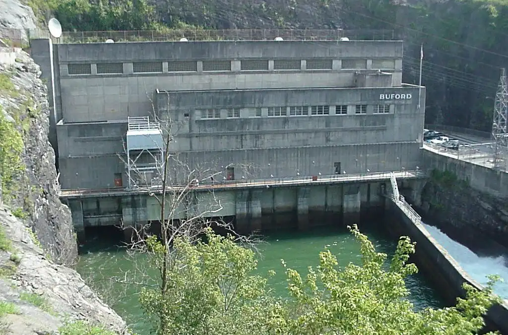
From North Georgia River Valleys to a Landmark Lake; Buford Dam.
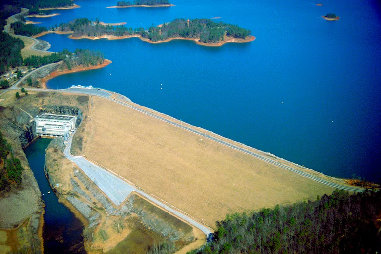
Nestled in the foothills of the Blue Ridge Mountains, Lake Lanier has become one of the most recognizable landmarks in North Georgia. Today, millions of people associate the lake with boating, fishing, camping, swimming, beautiful waterfront homes, and summer vacations. But Lake Lanier is not a natural lake. Its story began with a massive federal construction project that permanently changed the landscape of North Georgia.
Officially named Lake Sidney Lanier, the reservoir was created by the construction of Buford Dam across the Chattahoochee River. The lake also receives water from the Chestatee River and stretches into several North Georgia counties, including Hall, Forsyth, Dawson, Lumpkin, and Gwinnett.
The Idea Behind Lake Lanier
Plans for controlling the Chattahoochee River developed during the first half of the twentieth century as communities throughout the Southeast searched for better ways to control flooding, generate electricity, improve navigation, and manage growing water needs.
Congress authorized the Buford Dam project through the River and Harbor Act of 1946. The project would become part of the larger Apalachicola-Chattahoochee-Flint river system. Its purposes included flood protection, hydroelectric power, navigation, water supply, water quality, recreation, and conservation of fish and wildlife.
Construction activities associated with the project began in the early 1950s. The main dam contract was awarded in 1954, and the overall project was essentially completed by 1957. The first generating unit began operating that year, while the powerhouse later became an important source of hydroelectric generation for the region.
Creating a Lake Changed North Georgia
Building Lake Lanier required far more than constructing a dam. Thousands of acres of land had to be acquired before the valleys could be flooded.
According to historical records from the U.S. Army Corps of Engineers, the federal government acquired rights to more than 56,000 acres and relocated more than 700 families while preparing for a reservoir of roughly 38,000 acres. Homes, barns, wells, fences, roads, and other structures had to be removed or relocated before the water rose.
For the families who lived there, the project represented an enormous change. Farms and communities that had existed for generations disappeared from the familiar landscape as the reservoir filled.
This history has contributed to the fascination surrounding what lies beneath Lake Lanier. Old roadbeds, foundations, and traces of the landscape that existed before the reservoir remain part of the lake's story. While legends about the lake have grown over the decades, the documented history itself is remarkable enough: an enormous section of North Georgia was transformed within only a few years.
Why Is It Called Lake Lanier?
The reservoir was officially designated Lake Sidney Lanier by federal law on March 29, 1956.
It was named in honor of Sidney Lanier, the nineteenth-century Georgia-born poet, musician, and writer. Lanier was born in Macon in 1842 and became known for works celebrating the landscapes and natural beauty of the South.
As construction progressed and the Chattahoochee and Chestatee river valleys filled, the newly created lake quickly became one of the defining geographic features of modern North Georgia.
Buford Dam
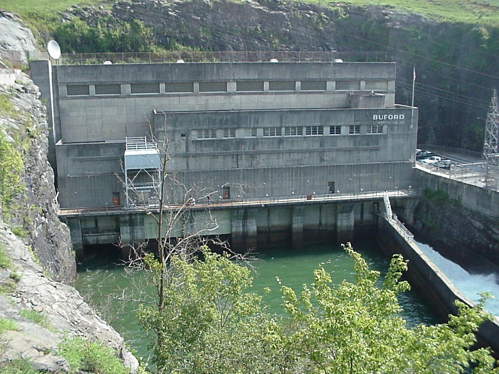
At the southern end of the lake stands the structure responsible for its creation: Buford Dam.
The earth-filled dam is approximately 192 feet high and 2,360 feet long. Behind it lies an enormous volume of water. At the lake's winter-pool elevation, the Corps estimates that Lake Lanier contains more than 624 billion gallons of water. The deepest area is near Buford Dam in the original river channel, reaching approximately 160 feet when the lake is at full pool.
The dam continues to perform many of the functions envisioned when the project was authorized. During periods of heavy rain, Lake Lanier can store runoff and reduce flooding downstream. Water passing through the powerhouse can also be used to generate electricity.
Perhaps most importantly for modern Georgia, Lake Lanier has become a vital part of the region's water system, particularly as metropolitan Atlanta and surrounding communities have experienced tremendous population growth.
Lake Lanier Becomes a Recreation Destination
Although Lake Lanier was created primarily as a multipurpose federal water project, recreation quickly became one of its most visible roles.
The lake has more than 690 miles of shoreline, more than 100 small islands, dozens of recreation areas, campgrounds, parks, boat ramps, and marinas. Fishing, boating, swimming, camping, hiking, and picnicking have attracted generations of visitors.
Over time, businesses, restaurants, resorts, marinas, neighborhoods, and tourism attractions developed around the shoreline. The lake became closely connected with communities such as Gainesville, Buford, Cumming, Flowery Branch, and other towns throughout North Georgia.
The U.S. Army Corps of Engineers reports that Lake Lanier welcomes millions of visitors annually, making it one of the country's most heavily visited Corps lake projects.
An Important Part of North Georgia History
More than seven decades after construction began, Lake Lanier continues to shape North Georgia.
It supplies water, helps manage flooding, supports hydroelectric generation, provides wildlife habitat, and serves as a major recreational and tourism destination. Yet beneath today's busy lake is another chapter of Georgia history—the river valleys, farms, roads, and communities that existed before Buford Dam changed the landscape forever.
Lake Lanier's history is ultimately a story of transformation. What began as one of the largest public works projects in Georgia became a defining feature of the region and an important part of everyday life for millions of people.
For those of us who live and work in North Georgia, Lake Lanier is much more than a place on the map. It is part of our local history, our economy, our recreation, and the story of how North Georgia grew into the region we know today.
*** Don't forget you can always find Creative Printing & Signs on social media as well. Here are our pages: Facebook, Instagram, Pinterest, and LinkedIn. You can also get all our past news by clicking here.
- Business Cards
- Banners
- Yard Signs
- Vehicle Graphics & Wraps
- Window Graphics
- Storefront Lettering
- Posters
- Brochures
- Door Hangers
- Custom Stickers & Labels
- Aluminum & Coroplast Signs
- Promotional Products
- Apparel Printing
- Restaurant Menus
- Coil-Bound Booklets
- And much more.